| : Ordnance Survey Benchmarks that can be observed along : | the Gloucester/Sharpness Canal |
< other canal Benchmarks for copy/paste |
|
| Llanthony Warehouse, Canal Museum |
| ( 11.6M above sea level) (not accessable) | |
| streetmap of SO 8271 1817 or | |
| what3words /// crisp.toast.things | |
| click image to enlarge |
  | Mariners Church, Gloucester Docks |
| ( 12.0M above sea level) | |
| streetmap of SO 8274 1823 or | |
| what3words /// police.posts.luck | |
| click image to enlarge |
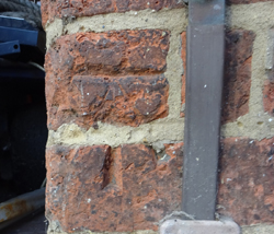
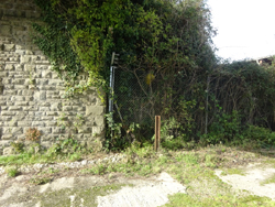
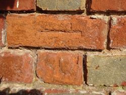  | factory, next Hempstead swing bridge |
| ( 11.2M above sea level) | |
| streetmap of SO 8194 1640 or | |
| what3words /// cable.plot.salads | |
| click image to enlarge |
  | Sims Bridge, Sharpness Canal |
| ( 13.7M above sea level) | |
| streetmap of SO 8094 1553 or | |
| what3words /// kings.verbs.homes | |
| click image to enlarge |
  | Rea Bridge, Sharpness Canal |
| ( 13.3M above sea level) | |
| streetmap of SO 8056 1505 or | |
| what3words /// books.gallons.frock | |
| click image to enlarge |
  | Sellars Bridge, Gloucester-Sharpness canal |
| ( 13.7M above sea level) | |
| streetmap of SO 7962 1350 or | |
| what3words /// being.full.smooth | |
| click image to enlarge |
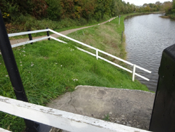
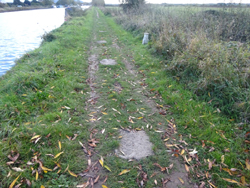
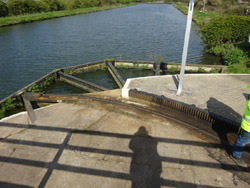
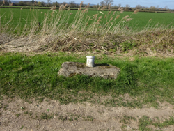
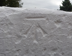  | bridge ramp, Saul Junction |
| ( 10.9M above sea level) | |
| streetmap of SO 7564 0930 or | |
| what3words /// farmer.emeralds.commuted | |
| click image to enlarge |
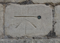
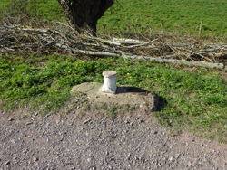
 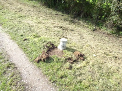 | mooring post, G & S canal |
| ( 10.3M above sea level) | |
| streetmap of SO 7411 0620 or | |
| what3words /// generated.will.raft | |
| click image to enlarge |
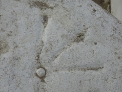
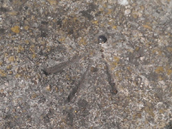
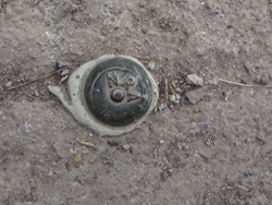
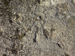
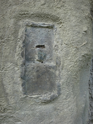
  | rivet set in concrete, Gloucester, & Sharpness canal |
| ( 10.5M above sea level) | |
| streetmap of SO 7429 0738 or | |
| what3words /// reader.trump.chef | |
| click image to enlarge |
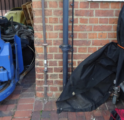
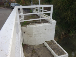
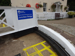
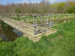
   | Cambridge Arm bridge, Sharpness canal |
| ( 10.5M above sea level) (from the bridge-keeper) | |
| streetmap of SO 7371 0497 or | |
| what3words /// downs.mural.public | |
| click image to enlarge |
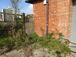
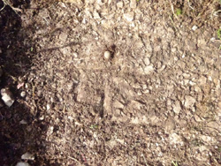
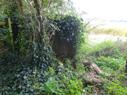
  | Cambridge Arm, canal |
| ( 11.0M above sea level) (abandoned) | |
| streetmap of SO 7429 0490 or | |
| what3words /// weekday.befitting.sweeter | |
| click image to enlarge |
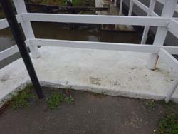
  | between Patch &, Cambridge Arm bridges |
| ( 10.7M above sea level) | |
| streetmap of SO 7332 0468 or | |
| what3words /// lays.cheer.peroxide | |
| click image to enlarge |
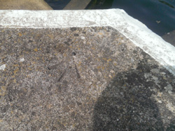
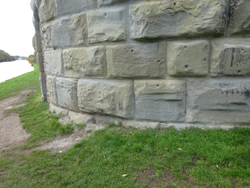
  | Weir, Gloucester - Sharpness canal, Purton |
| ( 11.3M above sea level) | |
| streetmap of SO 6870 0440 or | |
| what3words /// relegate.tentacles.jars | |
| click image to enlarge |
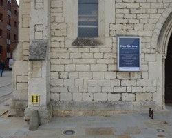
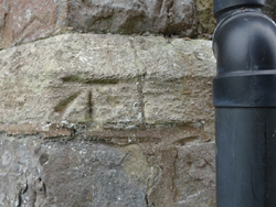 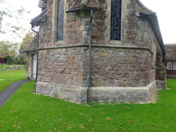 | St Johns Church, Purton |
| ( 13.0M above sea level) | |
| streetmap of SO 6917 0417 or | |
| what3words /// clots.unopposed.deploying | |
| click image to enlarge |
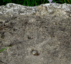
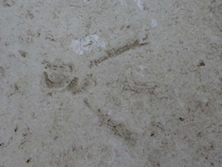
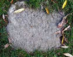
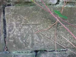
  | concrete base, to a bollard |
| ( 10.6M above sea level) | |
| streetmap of SO 7238 0401 or | |
| what3words /// assemble.unspoiled.strapping | |
| click image to enlarge |
  | end of wall, between towpath & river |
| ( 10.8M above sea level) | |
| streetmap of SO 6799 0359 or | |
| what3words /// sculpture.marsh.sweetener | |
| click image to enlarge |
  | base of the rotating mechanism, for the rail swing bridge |
| ( 10.7M above sea level) (bridge removed) | |
| streetmap of SO 6780 0339 or | |
| what3words /// cheetahs.lawful.lunch | |
| click image to enlarge |
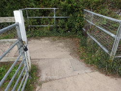
  | docks, road & rail swing bridge, abutment |
| ( 11.9M above sea level) (no just pedestrian) | |
| streetmap of SO 6732 0288 or | |
| what3words /// pretty.squaring.kickbacks | |
| click image to enlarge |
| X | 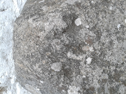
|
X |
| ffff | info | |
| < | > |